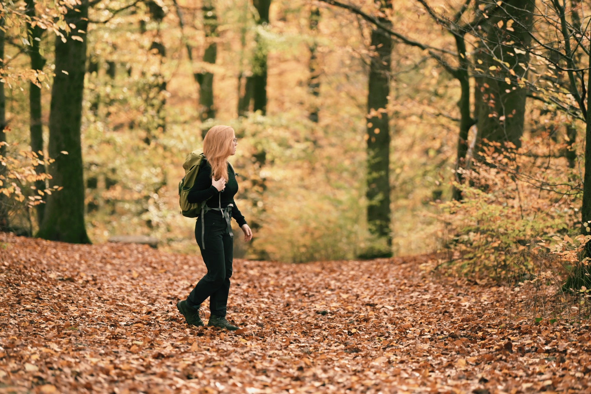
I often hear people disregard the Canary Islands as a holiday destination for hiking or enjoying the beauty and calmness of untouched nature. That‘s mostly due to the islands’ reputation for cheap mass tourism. However, most of the islands have so much more to offer, beyond hotel blocks and cheap fast food. There‘s stunning nature, incredible views, and a lot of solitude and peace if you look for it. I‘ll share with you 3 of the best hiking trails I did on Fuerteventura, the second largest of the Canary Islands, as well as everything you need to know if you‘re considering a (hiking) holiday on Fuerteventura.

What’s the Canary Island Fuerteventura like?
Weather and Geography on Fuerteventura
Fuerteventura is located in the Atlantic Ocean. It‘s one of the Canary Islands and part of the North Africa region at about the same latitude as Florida and Mexico. Its climate is considered mild and stable with average temperatures between 18 °C (64 °F) and 32 °C (90 °F), but mostly windy throughout the year. That‘s why it‘s a prime location for water sports enthusiasts as well as anyone who wants to enjoy the steady sunshine on one of the island’s 152 beaches. Mostly due to its mild and steady climate, Fuerteventura is also referred to as the island of eternal spring. I think that‘s a beautiful name and captures the essence of Fuerteventura rather well.

The island was declared a biosphere reserve by UNESCO in 2009 and features stunning nature. From beautiful beaches to breathtaking views from various craters and hilltops. Most people know Fuerteventura either as a hot spot for surfing or as a relatively cheap all-inklusive-hotel-package destination. Which, I guess, are the two things that most people come for. But Fuerteventura has so much more to offer.
I went there for the first time in 2022 and was extremely surprised by the beauty of the island. Given that I‘d normally choose a rich, green forest over nearly anything, that means quite something - Fuerteventura‘s landscape is almost entirely volcano desert. Or so I thought. Because if you look a bit closer you‘ll find incredibly stunning views, rough cliffs and soft white beaches, birds, squirrels, and a surprising variety of vegetation. Thus, hiking on Fuerteventura means exploring quite a varied landscape. From seemingly endless dunes of white desert sand to rough volcano craters and breathtaking views over the entire island and sea.
The north of Fuerteventura island
The north of the island has a very lovely, relaxed atmosphere, especially in little towns like Lajares or El Cotillo. There are quite a few nice little coffee places, restaurants, and bars to hang out. I can recommend La Panateca for great bread and Foccacia and Restaurante Canela Café for life Jam sessions in the evenings. Bar & Restaurante Bagus in El Cotillo offered quite a few vegetarian food options for a small lunch by the beach. From there you could also start your first (small) hike on Fuerteventura, right along the coastline until you reach the beautiful little lighthouse Faro del Tostón.
Given the super chilled atmosphere, the gorgeous beaches, and nature around, I spent nearly all my time in the north of the island. Apart from one hike to the highest point of the island, which is in the south on Pico de la Zarza. In addition to enjoying outdoor activities like hiking on Fuerteventura, many people also come to escape the cold, wet winter most of Europe has to endure from November to March. So adding a week or two of remote working on Fuerteventura can be a real game changer.

Co-working on Fuerteventura
There‘s also a variety of co-working spaces, in case you‘re considering adding a week of remote work to your hiking trip. Surfescape is one of my recommendations, which is a super cute hostel offering a large, beautiful co-working space with solid wifi, a café, and a pool. People are really friendly and you can take surfing or yoga lessons there, too. The only downside, if you have a lot of calls, the co-working space might be a bit too busy, but there‘s a meeting room you can book and many rooms also have desks.

Most beautiful beaches on Fuerteventura
Of course, being an island, Fuerteventura has plenty of beautiful beaches - 152 of them to be specific. In total, there are around 75km of beach, 50 km (31 mi) of white sand, and 25 km (16 mi) of black volcanic shingles. The island has even been awarded a few prices and recognitions for its outstanding beaches. They’re all a little different, so they offer a lot of variety in terms of activities: You can swim, scuba dive, surf, or take a long extended walk. Honestly, any beach on the island is great! Some of the most famous ones are Playa de Cofete, Playas de Jandia, Playas de Corralejo, Playa de Ajuy, and Playas de El Cotillo. Just to name a few. Personally, I have two favorite beaches. One on the west side of the island, close to El Cotillo. It‘s called Playa de Los Lagos. The other one, Playa del Moro, is located on the east, in the Parque Natural de Corralejo where the famous dunes of Corralejo are. Both have a very different feel to them, but both are incredibly beautiful.
I know beach hiking isn’t for everyone. I personally greatly enjoy a long hike (or walk) along a serene beach, especially if the beaches are as beautiful as they are on Fuerteventura. If you’re like me, check out my favourite beach hikes on Fuerteventura.

Nature and Hiking on Fuerteventura
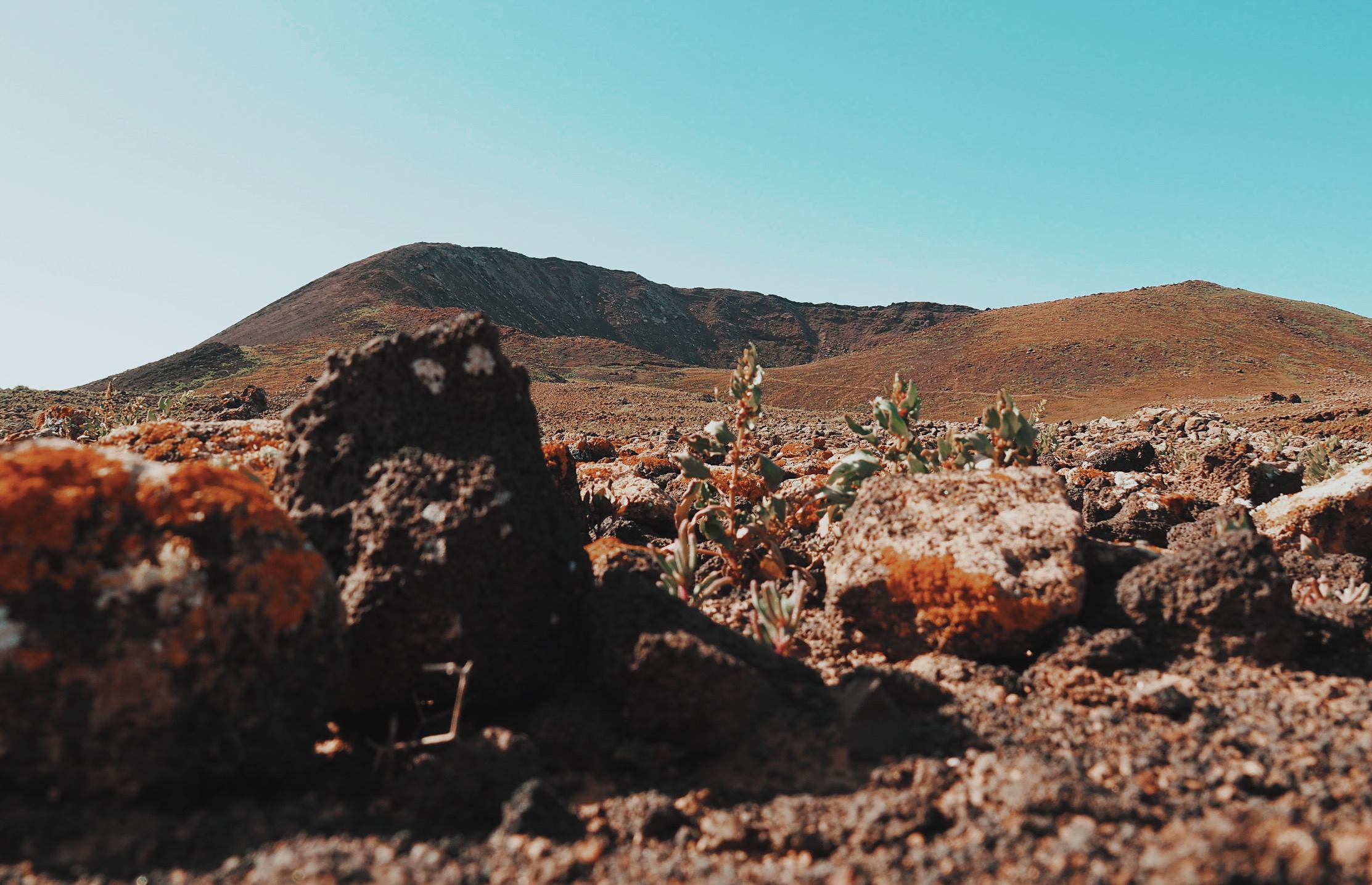
The nature on the island really surprised me. I wasn‘t expecting to see a lot if I‘m being very honest. But I was proven wrong. Although from your car, most of the hills and vulcanos might look completely dead and deserted of life, once you get a little closer, you will see that there‘s actually a lot of life there. Their stony ground is largely covered with different plants, shining in earthy tones - from warm ochre over mellow green to dusty red. In between them, small lizards enjoy the warming sun and the occasional squirrel or rabbit will cross your hiking route on Fuerteventura if you‘re lucky.
I guess one benefit of the island being mostly known for surfing and packaged holidays is that fewer people venture out into the wild. On only one of my hikes I actually met other people, and that was the most famous trail on Fuerteventura up to Pico de la Zarza.

What do you need to know if you want to hike on Fuerteventura?
If you’re considering Fuerteventura as a destination for your next hiking adventure, there are a few things you should know beforehand.
- Most hiking routes on Fuerteventura are quite „easy“ in terms of elevation or distance. Most run over rather smooth ascends and descents and cover a distance of anything between 5 and 20km (although there is a long-distance trail on Fuerteventura, on which you could cross the entire island from north to south).
- The terrain can be quite challenging to walk. There‘s quite a lot of gravel covering the ground as some of the most stunning hikes climb up to a crater or cliff. Thus, you‘ll need some stability in your ankles. It‘s totally doable, though, and I actually found the lava stone to have much more grip than for example the chalkstone gravel I encountered when hiking the Alpe Adria Trail in Slovenia.
- There‘s an amazing variety of scenery when hiking on Fuerteventura. I know, I‘m even surprised writing that, but it‘s true. You can do long coastal hikes, both on endless white sandy beaches or along rough black cliffs. You can climb the hills to visit an old volcano crater or look down at the vast landscape and the island’s cost. You can even visit the nature park on another little island, Isla de Lobos, to the north-east of Fuerteventura.
- The weather is extremely nice all year round. And especially in the off-season. I planned my trip to Fuerteventura at the end of November and the weather was perfect. For an entire 3 weeks, we had beautiful sunshine at 20-25 degrees Celsius. However, there is quite a bit of wind and the sun is still very strong, so make sure to take both a windbreaker as well as plenty of sunscreen and sun protection for your head. Only in the last few days, we saw some rain on the island, which I actually loved. It was not only extremely moody but also turned the entire island green within a day! Nature is just amazing.

The 3 Best Hiking Routes I did on Fuerteventura
It definitely wasn’t easy to choose my favourite hiking routes on Fuerteventura. Especially as I also enjoy hiking along the beaches of Fuerteventura (although you might consider that walking rather than hiking, but who cares? 🤷♀️). So I decided to dedicate an entire post to the best beach hikes on Fuerteventura. Check it out if that’s something you’re also interested in. In this article I’ll focus on the inland hiking routes along the craters and hills.
So, without further ado, here are three beautiful hiking routes on the Canary Island Fuerteventura.
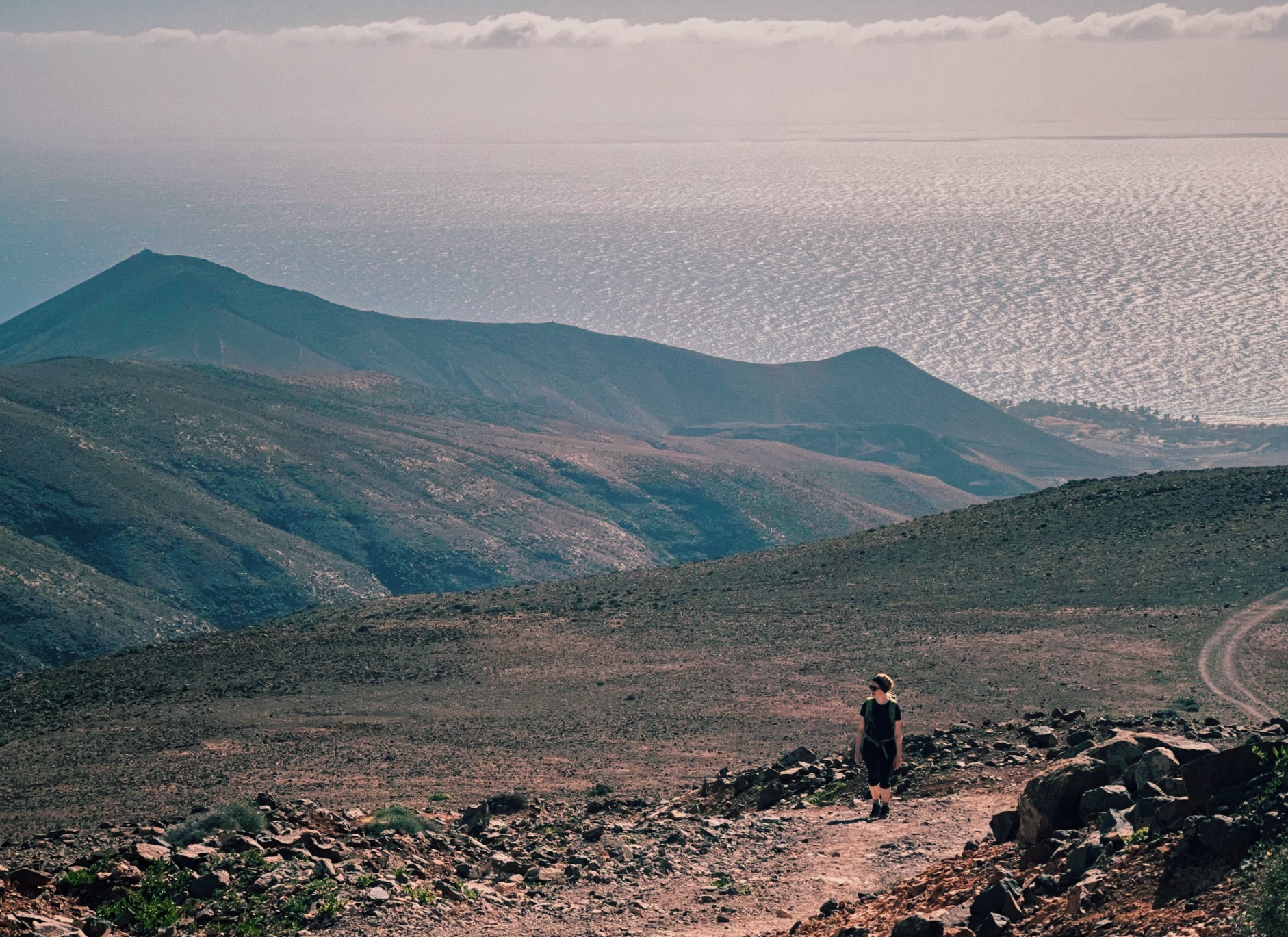
To the Highest Point of Fuerteventura - Climbing Pico de la Zarza
Distance: 12,7km
Elevation: 800m (-800m)
Starting Point: Parking Pico de la Zarza
You can download the gpx track here.
The hike up to Pico de la Zarza is without doubt the most popular hiking route on Fuerteventura. It was even quite busy in the off-season. And I can totally see why. The ascend in the blazing sun, was very exhausting. As we lived in the north of the island, it took us nearly 2 hours by car to get to the starting point, so we hit the trail rather later than I‘d normally like to. I‘d definitely recommend you start as early as you can to avoid being sizzled by the midday sun. One could call the ascent a little dull, especially in comparison to the other two hiking routes I’m recommending below. There‘s a pretty broad gravel path, which has been smoothened for an easy ascend. The landscape around is also a little less varied than further north. But I somehow found that extremely fascinating and capturing in itself. Also, I feel like hiking in a scenery like this really allows the mind to calm down, as there‘s very little distraction going on.

The hiking trail gets a bit more diverse once you reach the last third of the way up. From here on, the trail becomes steeper and a bit harder to navigate. It also gets a bit greener with more vegetation and quite a few birds, too. In parts, I thought it almost looked a bit like Hawaii (or at least what I think Hawaii might look like as I’ve never been).

In any case, the ascend is SO worth it. Once you reach the top, the view will definitely take your breath away. The rather shallow and steady ascend leads up to a giant, steep cliff. You can literally look down and see the almost 800m of elevation you just covered. It did make my stomach churn a little. But it‘s an incredible experience making you feel vibrantly alive in this very moment.

Through the middle of nowhere to Caldera Los Arrabales
Distance: 4.8km
Elevation: 123m (-123m)
Starting Point: Queseria Sabores Canarios
You can download the gpx track here. (This is the actual recording of my hike, so it‘s a bit messy, but there are not clear paths marked on any map, so it‘s not possible to properly track the route.)
I must admit, at first I was a bit skeptical about this hiking trail on Fuerteventura. I was proven wrong, though. It was an awesome hike! Mostly, because we had it all to ourselves. The entire time. The „trail“ (which to be honest doesn’t really exist, or at least I wasn’t able to spot it anywhere) leads around a big crater, the Caldera Los Arrabales. Which is located somewhat in the upper center of the island and sits literally in the middle of nowhere. We had some trouble finding a good parking location, as there‘s just the road and it‘s forbidden to park anywhere off the road that‘s not a dedicated parking area. We ended up parking at this cheese factory which was closed during the off-season but had quite a big freely accessible parking lot. It‘s also very close to the entrance of the nature reserve. Once you cross the road, it‘s only a few meters until you encounter a sign marking the entrance of the nature reserve. It urges you to stay on the trail. This seems easy enough at the beginning as there’s a very broad, flat trail leading towards the crater. However, it kind of vanishes after a short while and we had a really hard time finding the trail. We did our best following the gpx data I had downloaded beforehand, as I am a huge advocate of staying on the path and not disrupting the delicate flora and fauna more than absolutely necessary. I’m sharing my gpx track above, so you can follow it, too.

On the way up to the crater you‘ll pass through quite an eerie landscape. It almost feels like being on Mars - a vast empty landscape full of red volcano gravel furrowed by big, dried-up river beds. The mouth of the crater is also very impressive, just like the vast view from the top over the surrounding landscape. You can see far into the countryside, across several hills, and the incredibly colorful landscape. You can even make out a few farms and villages spotted around the vast desert.

When you reach the lower part of the crater, it surprisingly doesn‘t even look that steep. But once you reach the highest point that perception quickly changes. The track leads you once around the mouth of the crater so you can admire the view from all angles. If you’re into photography, I’d recommend planning your hike so that you reach the crater either early in the morning or late in the afternoon, when the sun is still rising or setting already. This will make everything look much more plastic, creating nice shadows and contrasts.

When descending, be very careful and watch your step as the loose gravel can be quite hard to navigate and it‘s easy to strain your ankle or slip and fall.

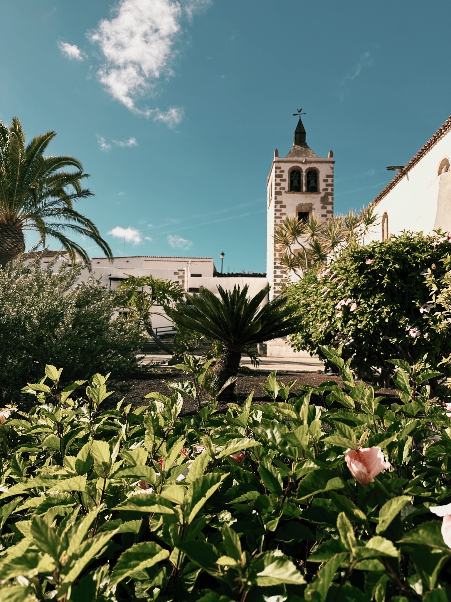
From a Cute Historic Village to Breathtaking Views Over the Island
Distance: 6,72 km
Elevation: 412m (-412m)
Starting Point: Parking De Betancuria
You can download the gpx track for the trail here.
This hiking trail on Fuerteventura starts in the cute historic village of Betancuria. It‘s a nice starting point, offering a managed parking lot with sanitary facilities. The price of parking was 3 Euro, but there are also quite a few parking spots on the streets around, so you don‘t necessarily need to park here. From the parking lot, you can cross the street and start a slow and steady ascend towards Morro de Tegetuno. Although the nature around looks just like a dry, volcanic desert from afar, I was surprised by how much vegetation there was on a closer look. It might have been due to the season or because it had rained a few days before, but there was a huge variety of small plants covering the rocky ground. You could only really make them out while walking, or at least I hadn‘t noticed them before while driving around the island.

The next highlight of the track is crossing the first hill crest at Degollade de Marrubio, giving you a breathtaking view over the inland and the sea on two sides of the island. Continuing up the hill with that incredible view on your right you‘ll soon reach Morro de Tegetuno at 648m.

This is a great spot to take some pictures or take a short break before you continue to ascend to Morro de Velosa, which is an even better viewpoint. Standing up there looking out over the vastness of the island and all that empty space in front of you is as impressive as it is humbling.

The descent isn‘t quite as exciting but offers a nice outlook over the village where you can end your hike with a nice cold drink and maybe some lunch or dinner. I did find most places here quite touristy, though, and ended up driving back to Lajares to have a Pizza at La Cancela for dinner instead.
Hiking on Fuerteventura offers serenity, beautiful nature and mesmerizing views
If you ever travel to Fuerteventura, I would definitely recommend venturing out into the wild and exploring the nature and hiking routes of the island. Most hiking trails are relatively easy and suitable for hiking beginners, too. Although the ground can sometimes be a bit more difficult to walk, especially on the paths that are a bit more off the beaten track (which is kind of their definition, I guess). There’s a huge variety in scenery, from endless beach dunes, to volcano craters and steep cliffs.
In short, hiking on Fuerteventura offers stunning nature, incredible views, and a lot of peace and solitude if you look for them.
If you want even more breathtaking views and an advanture of the more challenging kind, how about doing a Teide summit hike for an epic sunrise view on Tenerife, an other Canary Island? I can assure you, you won’t be disappointed.