Fancy a weekend out in nature with some stunning views and excellent hiking routes? Search no more, the Rheinsteig is one of the best destinations in Europe for a flexible hiking trip. The Rheinsteig is a long distance trail on the Rhine river in Germany. It stretches from Wiesbaden near Frankfurt to the former capital Bonn. Beyond the breathtaking views this trail offers, one of my favourite things about it is, that it’s so flexible. It’s the only long distance trail I know where almost each stage starts and ends close to a railway station. This means you can easily pick and choose the stages you want to hike to tailor them to your specific needs. For example, a weekend hiking trip!
2,5-Day Hike on the Rheinsteig - The Perfect Weekend Hike
I love spending my weekends outside of the city on a nature escape. Hiking is one of my favourite things to do. I’ve recently spent another weekend on the Rheinsteig and wanted to share my hiking route with you. I think it’s a great route for a weekend trip out in nature, especially if you live in the west of Germany, Belgium, or the Netherlands. You can very easily reach the start point by train (more information on taking the train to the Rheinsteig here). The stages are easy to medium difficulty with the more challenging stretches rewarding you with incredible views over the Rhine valley. There’s a good mix of varying nature and decent accommodation options along the route. You could even decide to camp, if that’s something you fancy.
Intrigued? Let’s look at my itinenrary for a 2,5-day weekend hike on the Rheinsteig.
2,5-Day Rheinsteig Itinerary Overview
1. Day: From Kestert to Kamp Bornhofen
2. Day: From Kamp Bornhofen to Braubach
3. Day: From Braubach to Lahnstein (or Koblenz)
I created individual gpx tracks for each stage of this itinerary. You can download them below in the in-depth descriptions.
Additionally, you can download the gpx track for the entire Rheinsteig trail here.
Detailed Stage Overview of my 2,5-Day Itinerary for Hiking the Rheinsteig
Day 1 From Kestert to Kamp Bornhofen
Distance: 11,73km
Elevation: 522m (-517m)
Accommodation: Liebenstein Castle, Villa Gast, Hotel Rheinkönig, Villa-Rheinblick, Hotel Anker
Highlights: Viewpoint after Hindenburghöhen Hütte, Brömserkopf viewpoint, Liebenstein Castle, Sterrenberg Castle, Himmelsleiter (stairway to heaven)
Download the gpx track for this stage.
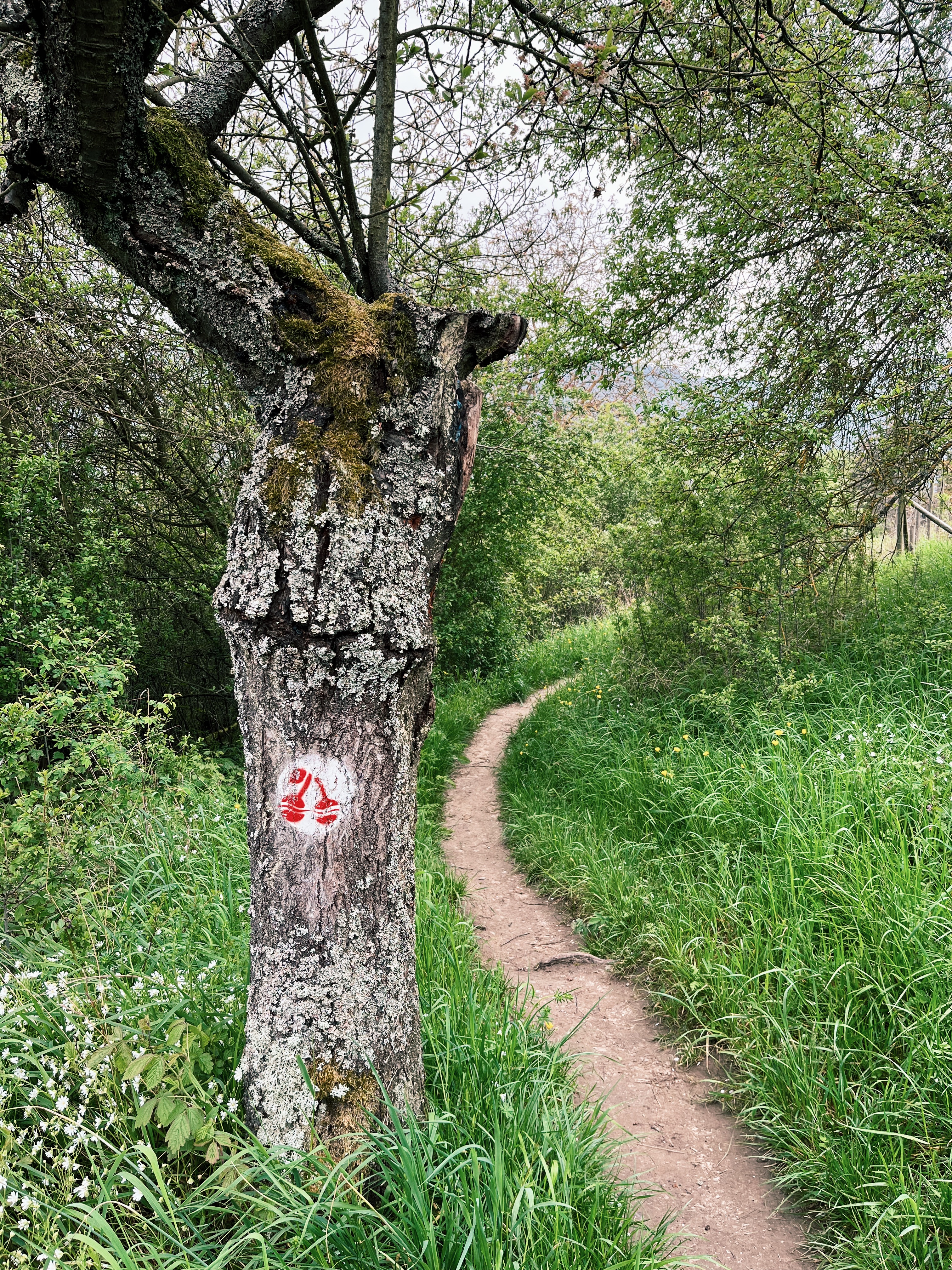
This is stage 9 of the Rheinsteig (walking direction south to north). It’s a shorter one, making it an ideal option for Friday afternoon, if you manage to get off work a little early for a weekend hiking trip on the Rheinsteig. Nonetheless, it’s a gorgeous stage with some absolutely stunning views.
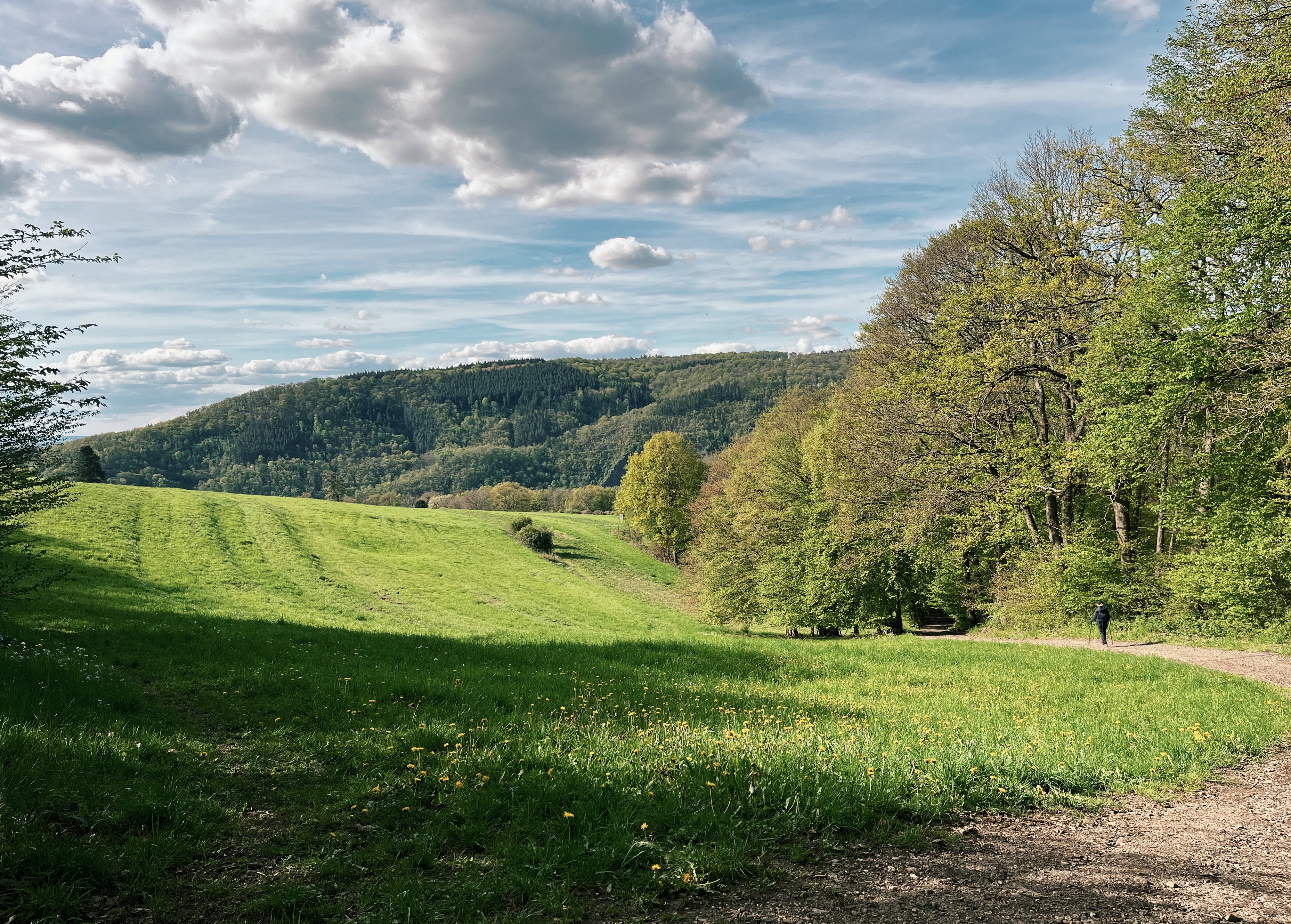
You start off at the train station in Kestert and immediately start your ascend through and up the beautiful vinyards, which are so typical for this region of Germany. Throughout this stage a great balance of rich forests and wide open views over the Rhine river await you. After just 2 km you reach today’s first hightlight: A stunning viewpoint, just after Hindenburghöhen Hütte. It’s the day’s first, but definitely not its last breathtaking moment. Moving on, the route will take you a bit more into the countryside and through the tiny village of Lykershausen. Meandering through the country side, the well-marked path leads you back towards the river. Hold off with taking a break, because after around 2/3rd of the route (roughly 6km) you’ll reach the absolute best spot for a break and some snacks. A stunning viewpoint called “Brömserkopf” from where you look out over the Rhine valley and two castles right next to each other: Burg Liebenstein & Burg Sterrenberg. That’s the stuff of fairy tales. You can either take a break here and munch on your own snacks (which I prefer to do) or you visit one of the two castles for a coffe and some cake. Burg Liebenstein is also a hotel, so you could even spend the night there if you wanted.
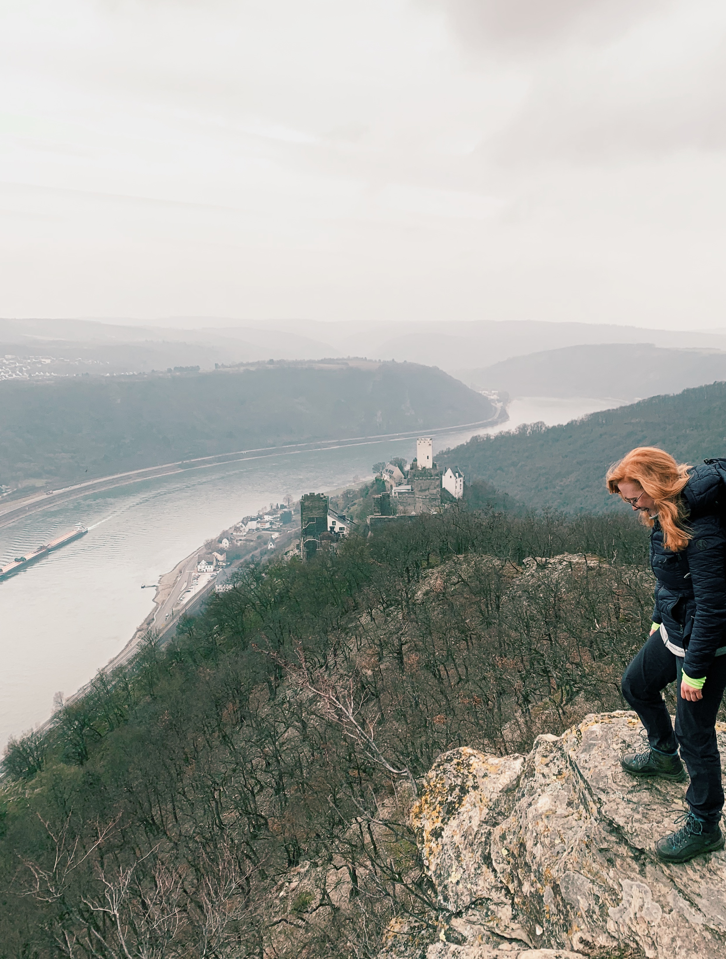
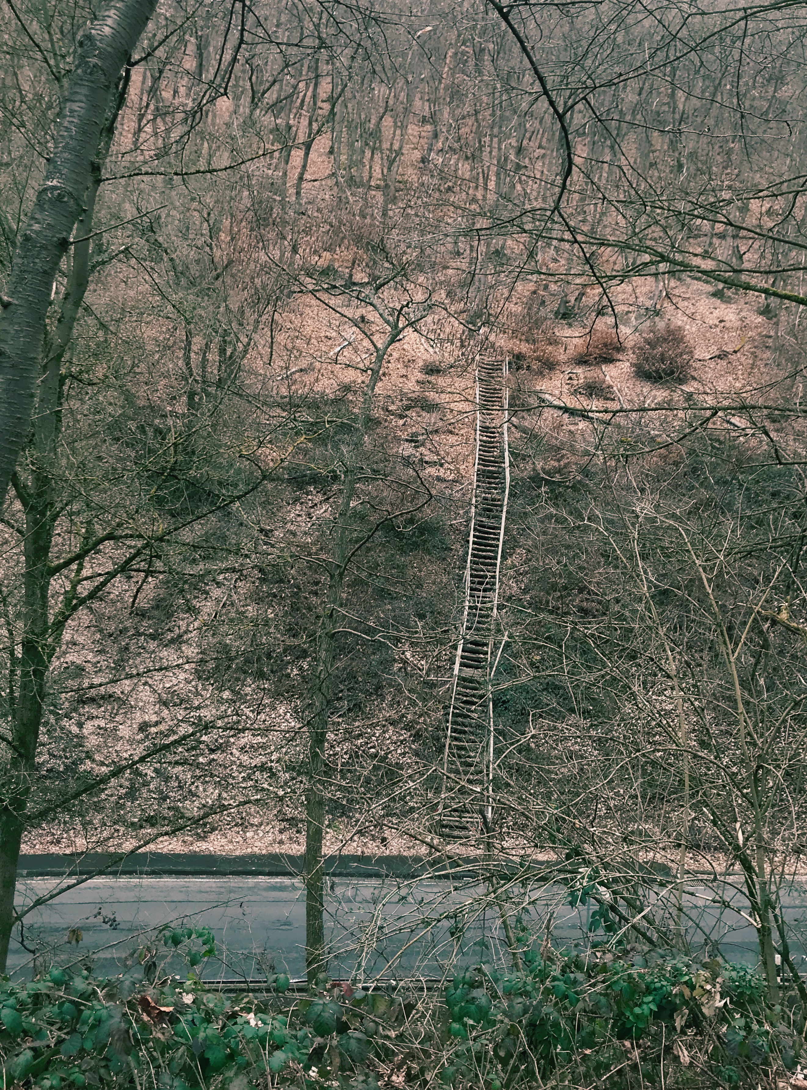
Once you’re well rested, march on, past the castles, decending down to the main road (“Loreley-Burgen-Straße”). Here, another highltight awaits: the Himmelsleiter (translating to stairway to heaven). They’re not kidding, these are some pretty steep steps. But don’t worry, it looks worse than it actually is (although, I kind of have to say that right now). I’ve read a few reviews on Google Maps which state that the staircase is in bad state at the moment. Please make sure to be safe, if it doesn’t look walkable there’s an alternative route up the mountain, just a few meters to the right of the staircase.
After having covered another good 100m of elevation, the route takes you along a few more beautiful viewpoints until you start your descend to Kamp-Bornhofen, the finishing point for today’s stage.
There are several different accomoodation options you can choose from in Kamp-Bornhofen. Some of them are a bit dated, but I guess that’s part of the charme of the region? There are also quite a few very nice holiday appartments. If you’re hiking during the summer or autumn season as well as during school holidays, I’d highly recommend to book in advanced, as accommodations are frequently booked out in this region.
Here are a few options that lie conveniently close to the hiking route, which you should check out:
Liebenstein Castle, a stuning medieval castle turned restaurant and hotel.
Villa Gast and Villa-Rheinblick, two cute holiday apartments
Hotel Rheinkönig and Hotel Anker, two a bit more traditional hotels
Day 2 From Kamp Bornhofen to Braubach
Distance: 17,35km
Elevation: 1007m (-1015m)
Accommodation: Hotel Garni, Hotel Garni Rabennestn Zum Weissen Schwan, Ferienwohnung Veit, Ferienhaus Braubach
Highlights: Kirschweg (cherry path), Kipplei Spitze, Marksburg
Download the gpx track for this stage.
Today we’re tackling stage 10 of the Rheinsteig (walking direction south to north). It’s definitely a bit more challenging than yesterday’s stage, covering a good 17 km and 1.000m of elevation up and down.
We’re changing the beginning of the original stage a little bit, because otherwise you’d walk “backwards” (as in back south) for a little bit, which I don’t like. Instead, we’ll keep heading north along a tiny beautiful path crossing green fields and steadily taking you up to an elevation of around 230m.
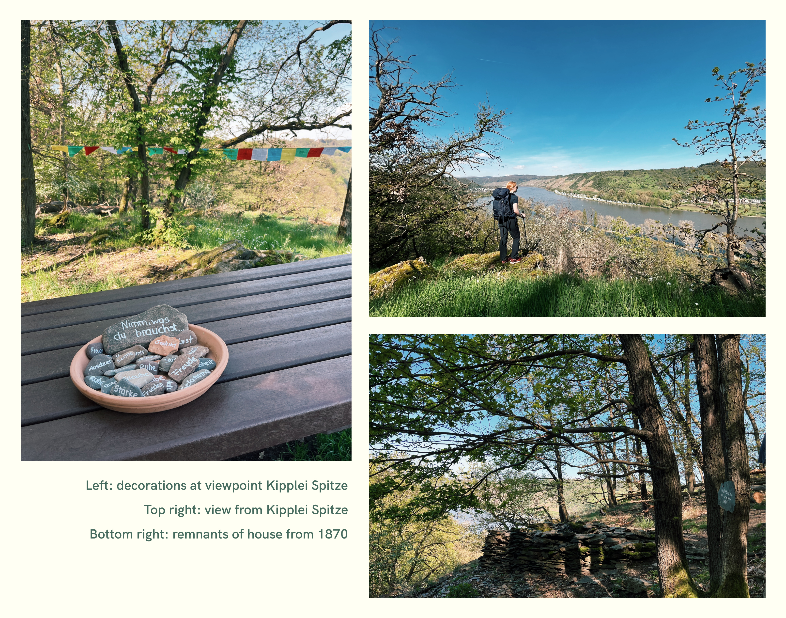
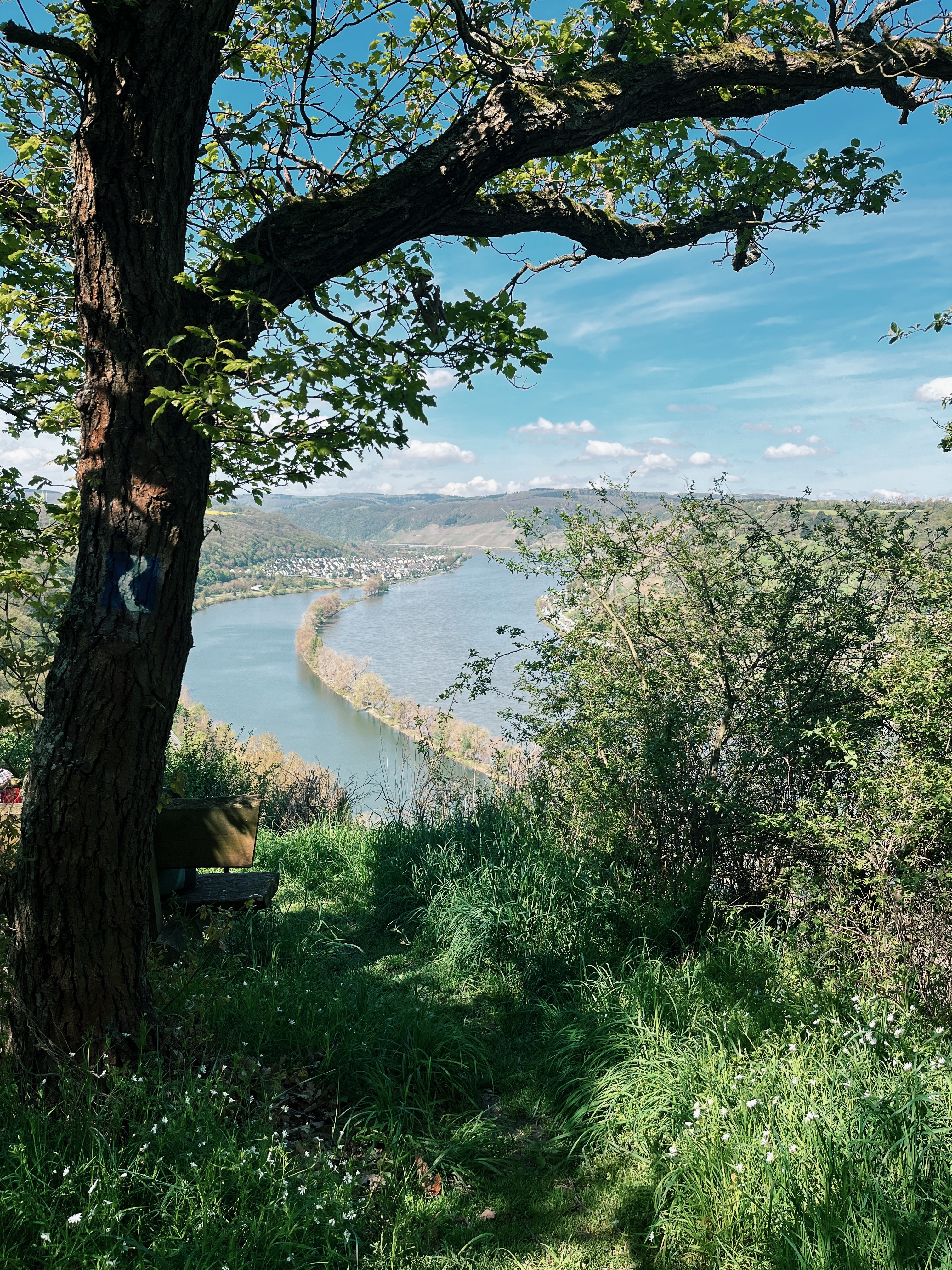
There’s a total of 10 marked viewpoints on the first 3km of this route, and I think I made an additional few stops to take pictures. The beauty of this area is just incredible. Moving on, you’ll take the bend just over Filsen towards Osterspai. I love the variety in landscape of this next stretch, from thick forests, through open meadows to unobstructed views over the Rhein valley. I especially liked the “cherry path”, winding through a nice meadow and along knarly, very old cherry trees. The municipality made an effort to make this somewhat of an educational path, putting up signs with information about the importance of cherry harvesting in the region. It’s quite interesting to stop at the signs and learn a bit along the way.
A great spot for a first break is the viewpoint Kipplei Spitze, which even offers some benches & tables for a comfortable rest. While we were there, they even put up some decorations, which I thought was quite cute. 🙃 You can also find the ruins of a small watch house there. Its remnants are from 1870.
Don’t get too comfortable, though, as there’s still quite a bit of distance ahead of you. As you make your way up and down the vinyards (all this elevation has to come from somwhere, right?), you’ll encounter more great spots, many of which have superbly placed benches to indulge in the views.
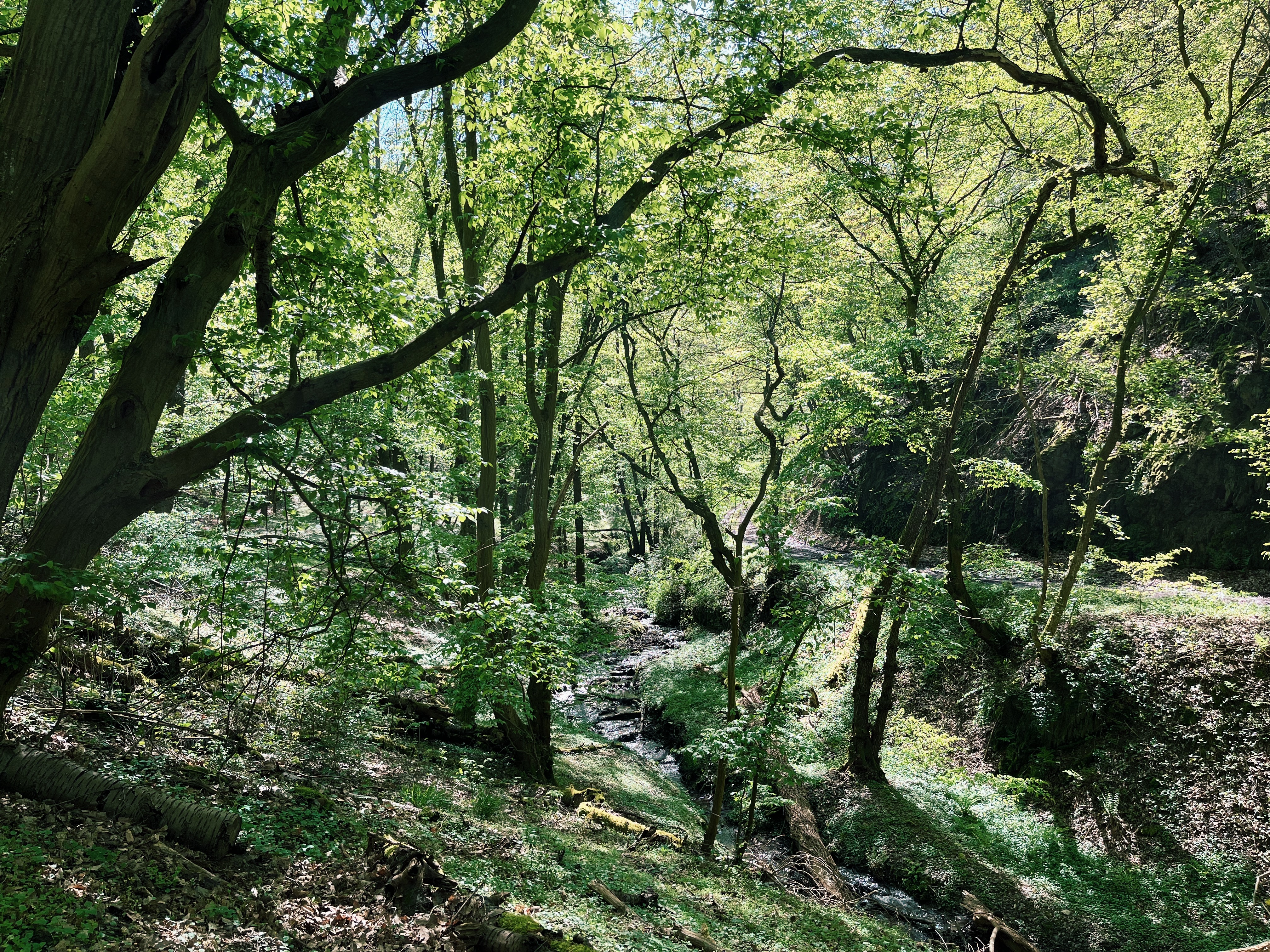
In addition, the path will lead you through incredibly rich forests, with a few cute little streams you can dip your feet into if you like (I know that’s not good hiking practice as you’re more likely to get blisters after, but I like it anyways.)
I always find it quite hard to not sit down at each and every spot, enjoy the views and have a little snack. Plus, there’s always the chance of making new friends.
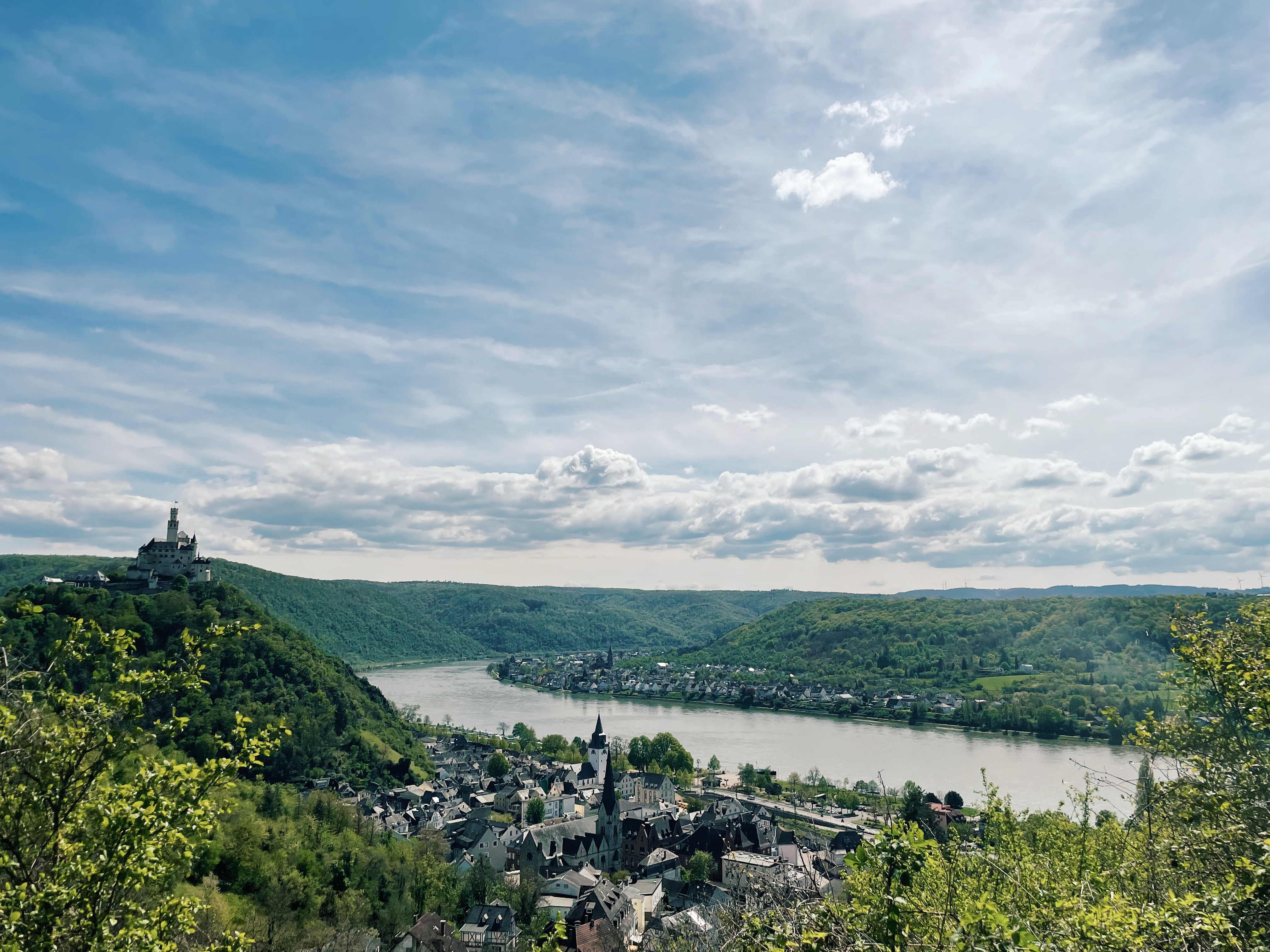
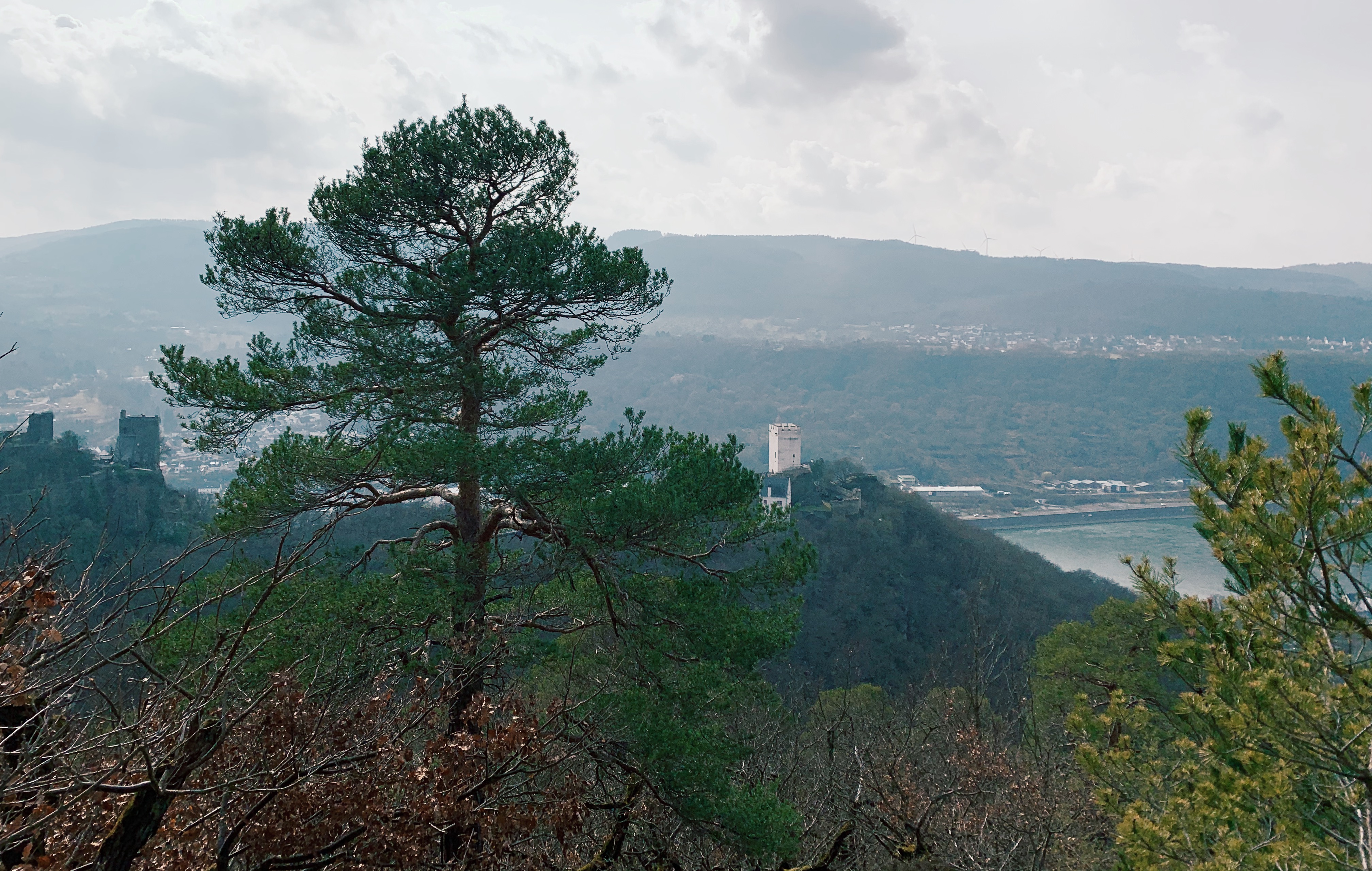
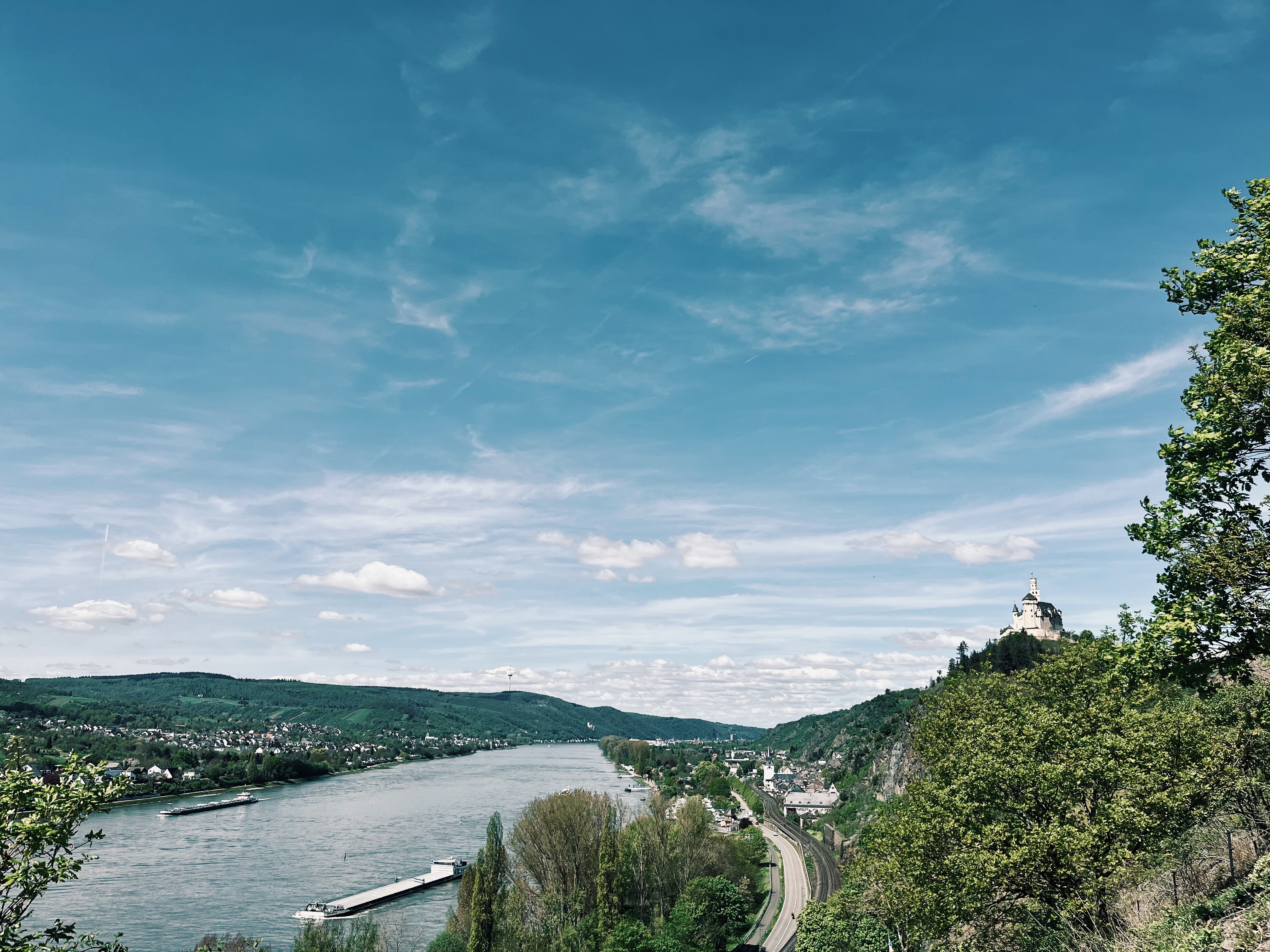
Continuing to head towards Braubach, you will soon spot another famous castle: the Marksburg. It’s the only castle along the middle Rhine River Valley that was never destroyed and thus offers some real medieval vibes. As the route will pass right by the castle, you could even book a private guided tour through it. I’m sure this could be really interesting. You can find more information on the Marksburg here.
Just after you’ve passed the castle, it’s only a short descend until you’ve finished the stage, reaching Braubach.
There are fewer accommodation options in Braubach, so I’d definitely make sure to book in advance. If, however, you can’t find anything, you can always take the train from Braubach back to Kamp-Bornhofen or on to Lahnstein after your hike and back in the morning.
Here are a few accommodation options in Braubach to check out: Hotel Garni and hotel Garni Rabennest, two more classic hotels, typical for the region
Zum Weissen Schwan, a more fancy option
Ferienwohnung Veit and Ferienhaus Braubach, two holiday apartments
Day 3 From Braubach to Lahnstein (or Koblenz)
Distance: 11,42m
Elevation: 413m (-414m)
Accommodation: Boutique Hotel “Altes Rathaus”, Historisches Wirtshaus an der Lahn, Ferienwohnung Edrich, Ferienwohnung Sporkenburger Hof
Highlights: Marksburg, Lahn river, Ernst-Wagner-Park, C.S. Schmidt-Brücke, Lahnmündung
Download the gpx track for this stage.
The last stage of this 2,5 days hiking itinerary is a slightly longer variation of stage 11 of the official Rheinsteig trail. It covers a comfortable 11,4 km & 400 m of eleveation, ending at Lahnstein train station, from where you can easily take the train back home. It’s a fairly easy stage, ensuring you’re not too exhausted when returning on Sunday evening. For those of you who like a good challenge, there is the possibility of combining stage 11 and 12 of the Rheinsteig instead, taking you all the way to Koblenz. This would mean around 20,9 km & about 760 m of elevation up & down for today’s stage.
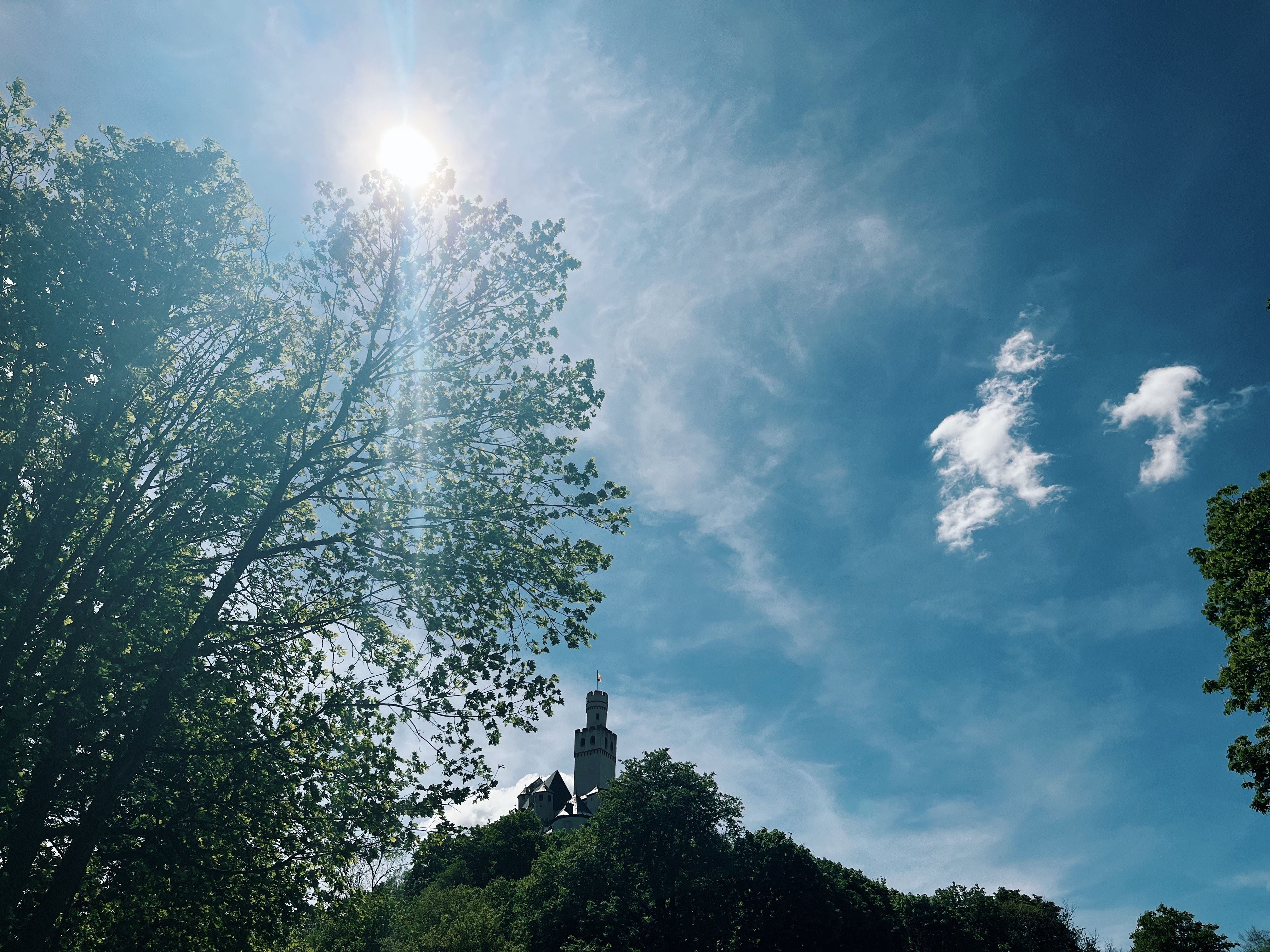
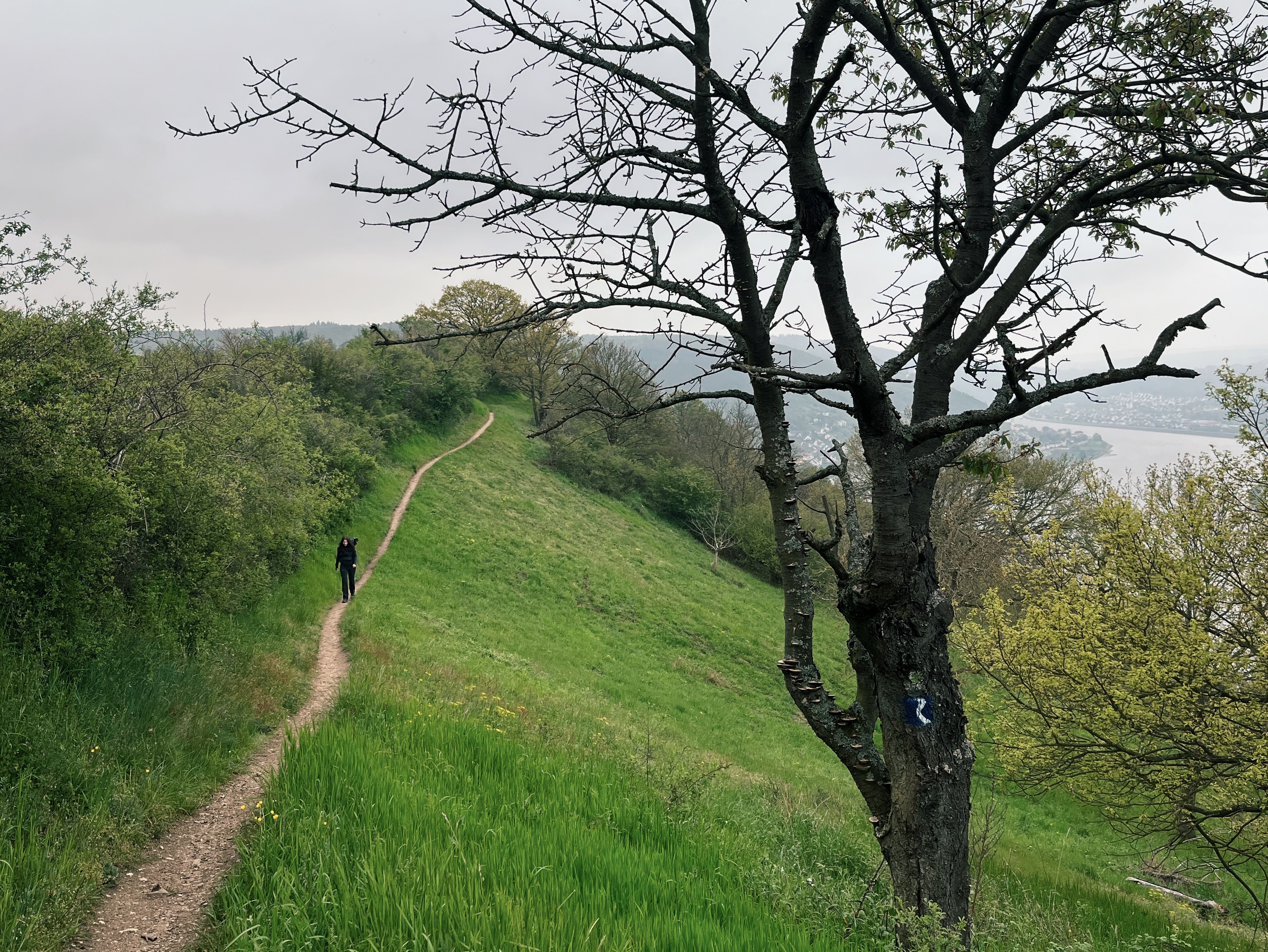
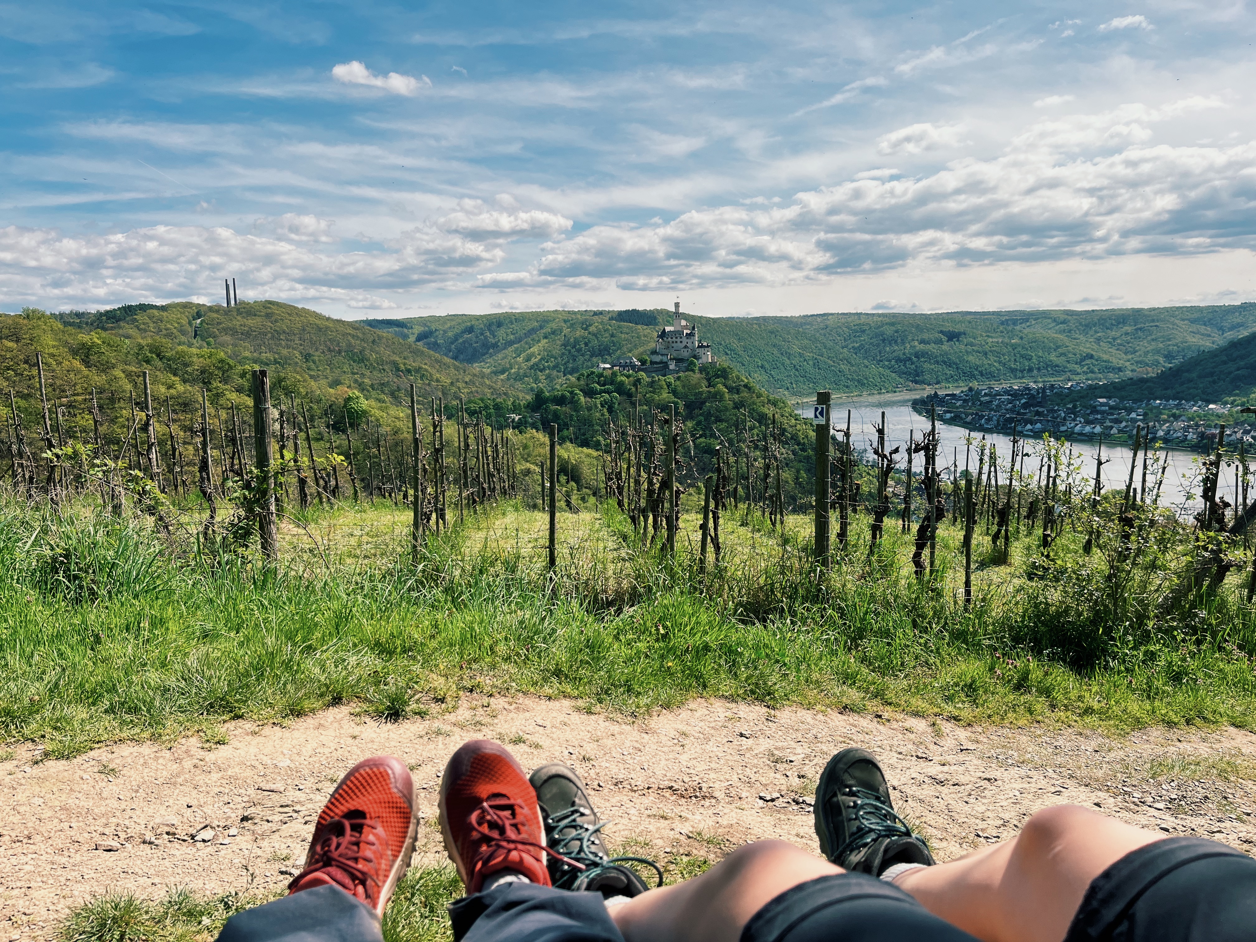
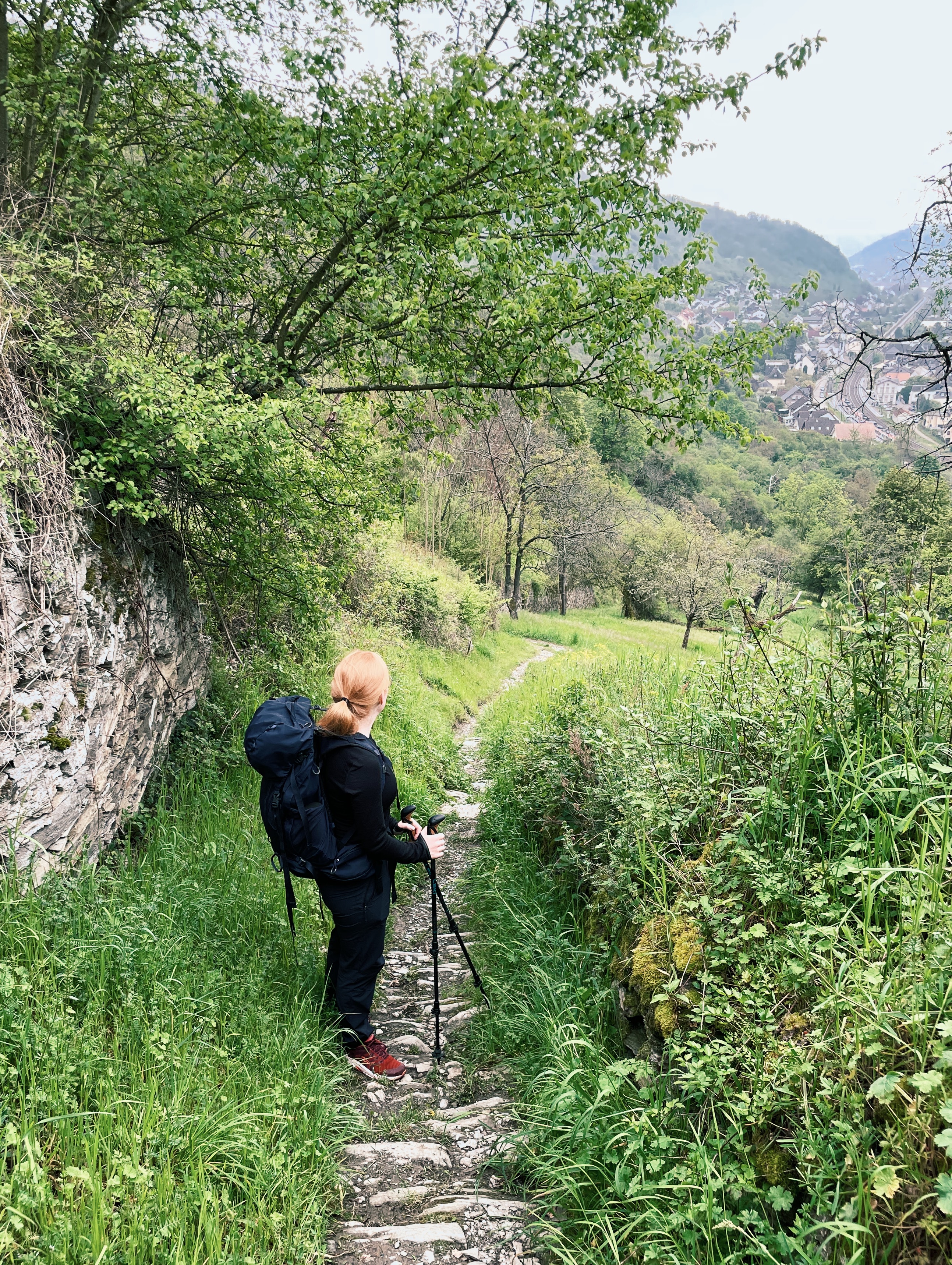
My favourite part of this stage is actually the very first stretch. After you’ve climbed up the hill, you’ll find the most amazing view of the Marksburg, Braubach at its feet and the Rhein river just behind it. To make it even better, there’s a great bench just at the top, offerign you the opportunity to indulge into the views. I’d totally recommend to pack your breakfast and enjoying it from up there, after the first ascend of the day is accomplished. What a great start to the day that’d be!
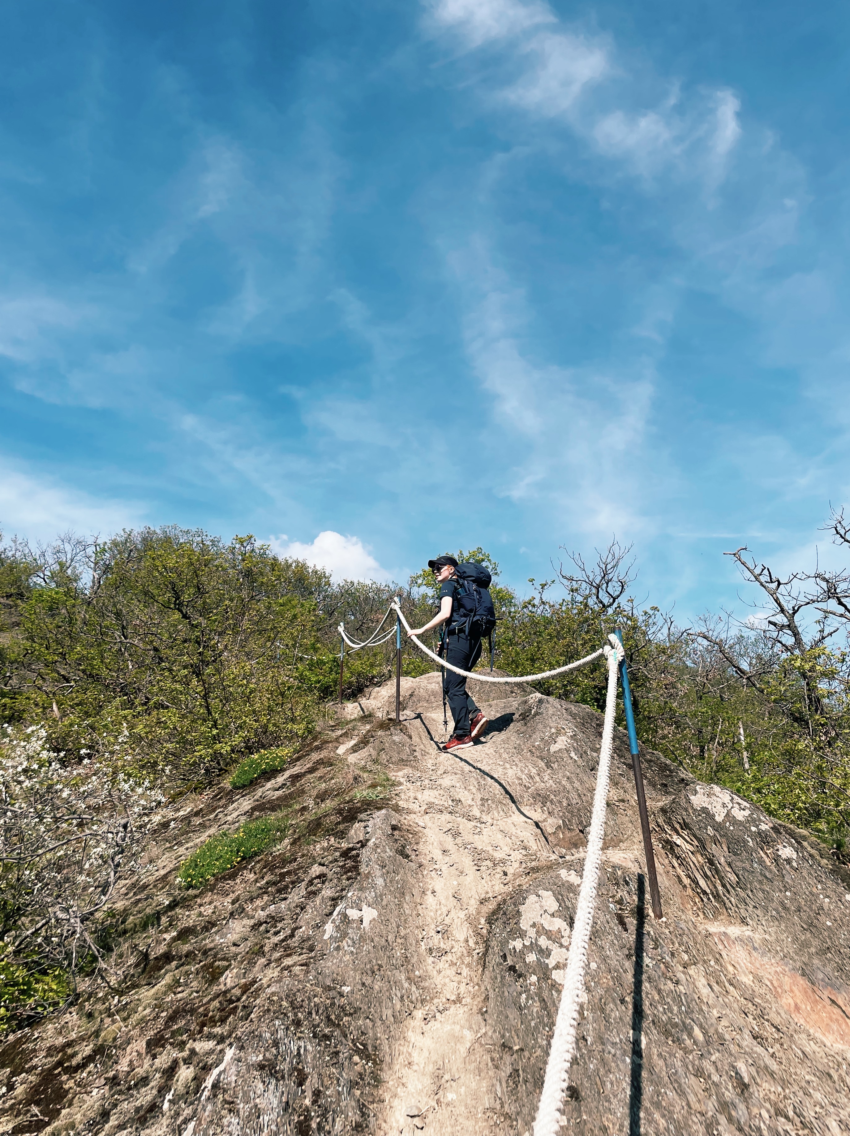
While the beginning of the stage is just a fairly steady ascend, there’s some adventure waiting just ahead. There is one stretch quite early on, which requires some climbing. There’s a pretty solid rope to help you climb across the bare rock. Don’t worry, it’s not along a cliff, but it is still quite steep and requires steady footing. The views from the top are totally worth it, though.
Afterwards, this stage offers some different scenery, as we’re moving away from the Rhine river valley, through the country side, and towards another river: the Lahn. One highlight of this stage is passing through the Ernst-Wagner-Park, a nicely manicured park, attracting quite a few visitors, especially in sunny weather. You can take a break at one of the benches here or move on towards the Lahn river. With your descend, another change of scenery is coming.
After crossing a beautiful bridge, you’ll spend the rest of the stage walking along the waterfront of the Lahn. It almost feels like walking along a canal with all the boats anchoring along the side arms of the river.
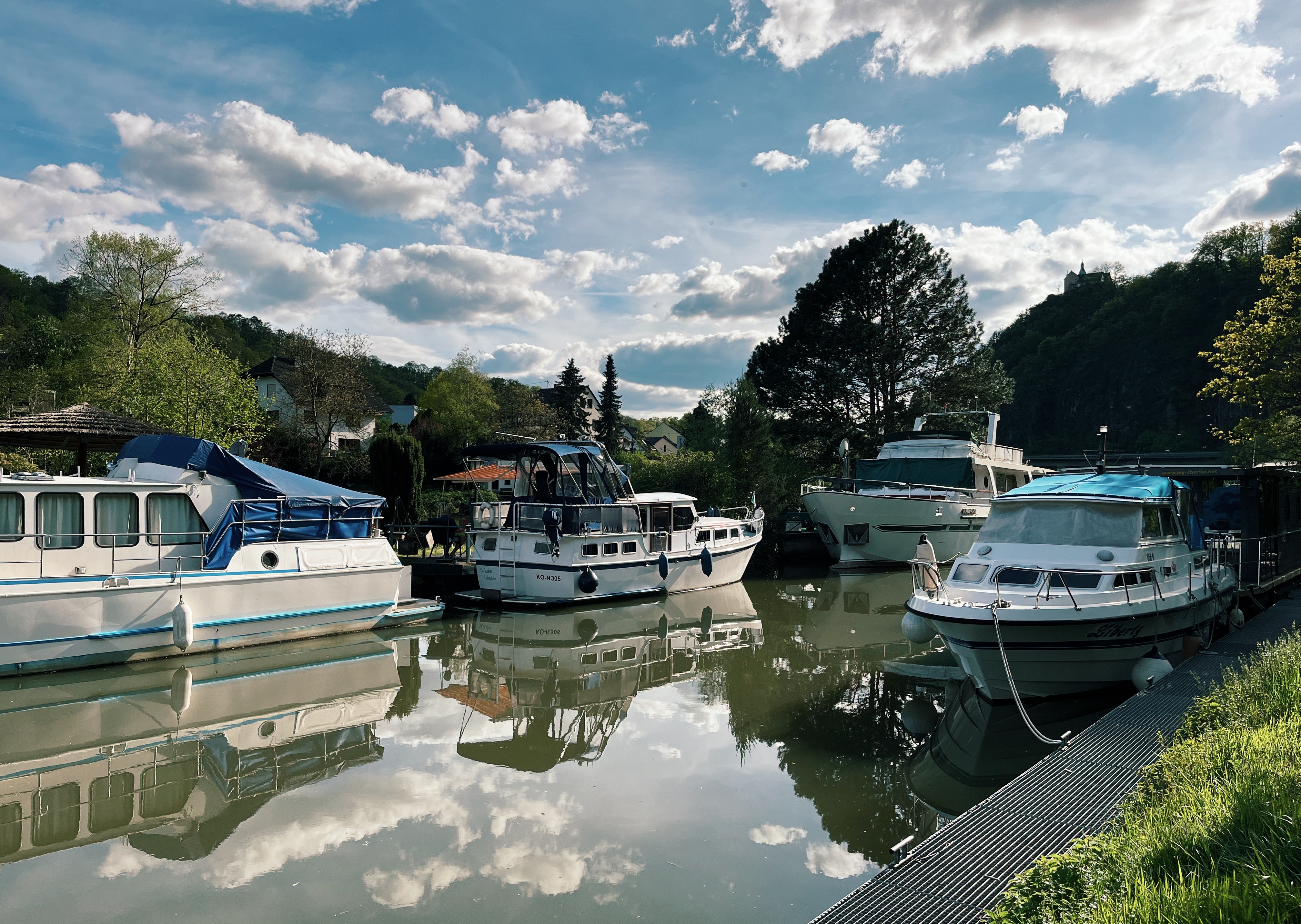
It’s a really nice, easy, yet beautiful walk, which is just perfect for the end of a hiking weekend out in nature. Maybe you’re even lucky enough to find an ice cream stand along the way (can’t promise anything, though). The last highlight of today’s stage is passing by the spot where the Lahn river flows into the Rhein river.
The last kilomoetre or so is a bit unspectacular as it just takes you through the small village of Lahnstein to the train station. But from my point of view, that’s totally acceptable after such an amazing rout you’ve covered today.
Theoretically, you won’t need accommodation for tonight, but just in case you want to stay an extra night and pack in an additional day of hiking, here are a few accomoodation options in Lahnstein:
Boutique Hotel “Altes Rathaus”, Historisches Wirtshaus an der Lahn, two nice traditional hotels
Ferienwohnung Edrich and Ferienwohnung Sporkenburger Hof, two holiday appartments
What to Pack for a Weekend Hike on the Rheinsteig?
I mean, to be honest, this is quite straight forward. Obviosuly, the golden rule is to pack as lightly as possible, while still making sure you take all the essentials. And this rule can vary greatly depending on the kind of hike you’re doing, your goals and preferences. Maybe you’re combining your hike with a little spa experience. In this case, you’d want to pack a bathing suit and, idk, a face mask? Or you want to do some nice wine tasting in the evenings, so a nice set of clothes would be great. I guess, what I’m trying to say is: weight does matter on a hike. But comfort and practicality matter, too. So, personally, I think for a shorter weekend hike it’s okay if your pack is a bit heavier, you won’t be carrying it quite as long or far. I think hiking should be fun and enjoyable, also beyond the road, so that’s an important factor for my packing.
I put together some guides and packing lists for long-distance hikes in Europe. I’d recommend you to check out my ultimate packing list for hiking the Alpe Adria Trail, as many items included here will also form your base for a shorter weekend hike on the Rheinsteig.
But make sure to tailor it. You won’t need a sleeping bag for this itinerary. Also, checking the weather forecast will help your reduce unnecessary weight, e.g. your fleece jacket can probably stay home if weather predictions are nice and warm. Same goes for a rain poncho. For a weekend hike this is super useful, as a 3 to 5 day weather forecast is much more reliable than a 3 to 5 week one.
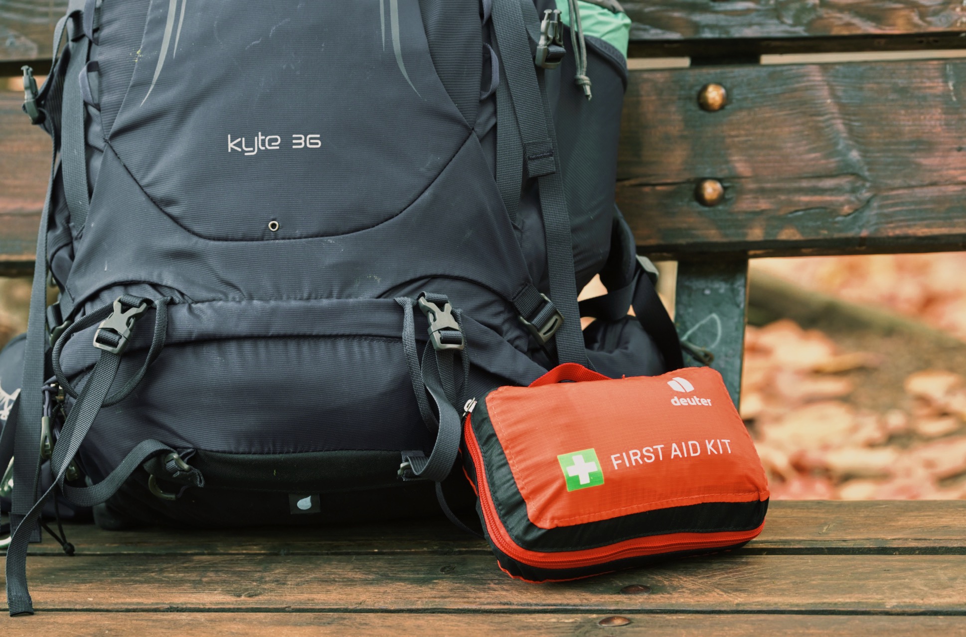
I highly recommend to always take a first aid kit, even if you’re not hiking off the grid. Because that untreated blister will still make your day hell, even if you do stay in a hotel at night. Same goes for an unexpected headache or heartburn. In this post I share what I include in my hiking first aid kit.
If you’d like to dive even deeper into my packing list recommendations check out these guides:
- Layer up! Which Clothes to Pack For a Long Distance Hiking Trail
- Packing List for Most Important Gear for the Alpe Adria Trail
- Packing List Food & Drink Equipment for a Long-Distance Hiking Trail
- Minimal Toiletry Packing List to Take on a Long Distance Hiking Trail
The Rheinsteig is the Perfect Trail for a Weekend Hike Out in Nature.
I hope this got you just as excited as I am about hiking the Rheinsteig. It really is a great trail for a weekend hike out in nature. Its easy access, breath-taking views, and balanced mix of difficulty levels make it the ideal choice for a lot of different hiking adventures.
The Rheinsteig consists of 21 stages in total, so there’s definitely no need to walk the same stage twice (although, they’re so beautiful, I honestly wouldn’t mind). I’ve done nearly all of the stages by now and have created another route for you. So, if you’re hungry for more, check out my 3-Day Rheinsteig Hiking Itinerary.